Keld to Bowes
- Dave
- Aug 16, 2019
- 6 min read
Updated: Jan 19, 2020
Pennine Journey – Day 4 – 13.5 miles
Variety is surely the spice of the long distance walk.
And so far the Pennine Journey, with its magic mix of moor, river, ancient settlements, imestone escarpments and studded woods, has held variety in spades.
That was to change today on one of the Pennine's notorious moorland crossings, where the only thing in abundance was marsh, as far as the eye could see.

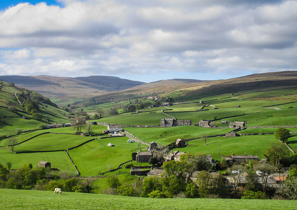
The day breaks with promise. Pinprick stars fade as an effervescent sidelight rises over the Pennine meadows. From the hillside hamlet of Keld, and the big windows of Keld Lodge, I watch the land turn from blue-green to gold, lambs in Maytime frolic.
Keld Lodge takes pride in – as the menu notes – "doing the simple things right". And while it isn’t going to win any Visit Britain Gold Awards, long distance walkers tend to have less lofty standards: as long as the bed's comfy, the food's filling and you can grab a pint after a day on the fells that's all you really need. Throw in a drying room and you've hit the jackpot. It's my second stay at the Lodge and it remains as reliably in-touch with walkers' needs as ever.
Generous veggie fry-up done and I'm away; this is no morning to be indoors.


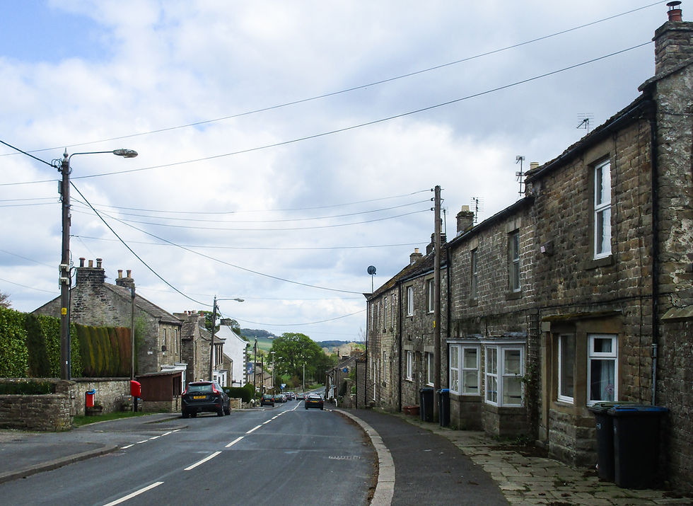
Strolling through the village I visit the Keld Resource Centre. It's an unobtrusive stone building at the side of the road, unmanned at 8.35am, that gives voice to the heritage (and people) of the valley.
The main theme is farming, and specifically, the field barns of the valley, collated in the 'Every Barn Tells a Story' exhibit.
These barns, and the wider field patterns and enclosures, are recognised as being part of one of the most distinctive agricultural landscapes in Western Europe. With roots stretching back to Viking times – when Scandinavian settlers discovered valleys with a feel of home – the barns are embodiments of a unique way of life.
Even in the remarkable landscape of the North Yorkshire Dales Upper Swaledale is unusual; with barns straddling strip fields every few hundred yards. Nor are these the tumbledown ruins you find in uplands elsewhere; instead they are immaculately built, the stonework handsome and the slate roofing good for another hundred years. Some even have extra architectural stonework flourishes; carved lintels and embossed window frames – the handiwork of fine masons.
But why so many barns?
It’s the kind of question you don't think to ask until you’re given the answer.
The answer is an unlikely combination. Cows and lead; the two industries that have shaped this valley.
Before farming transitioned in the aftermath of WWI to something more recognisably modern – and less hand-to-mouth subsistent – every family had a cow or two. They were insurance against the long winter. When the ground was producing nothing, and summer-stored stocks were running low, the cow was still producing milk, which could be processed into cheese – both of which might also be sold.
The cows needed shelter and food. Barns offered both: a home from autumn until June and a location to store the hay that would sustain them through the winter. Locating the barn as close to the meadow as possible allowed the farmer to walk the stacked hay from the meadow into the barn alongside. When summer came, meanwhile, they could take the cow muck from the barn and spread it back on the meadows to fertilise the soil – and wildflower-rich grass. Win, win.
So far, so good. But the sheer number of barns in Swaledale has a further explanation: so poor was income from these tiny, marginal farms that stockmen frequently took on extra work in the Swinner Gill and Beldi Hill lead mines. Time spent in the mines was time not spent in the meadows, so to keep farming operations as efficient as possible barns were built as near as possible to each pasture. Cue more and more barns. That the farmers were acquiring handy stone working skills down the mines may also help explain the unusually high levels of craftsmanship evident in the buildings.

While previous days on the Pennine Journey have crossed new country to me, today is a treading of old ways. Specifically, the Pennine Journey joins the Pennine Way and sticks with it for the best part of three days.
I like the Pennine Way, a lot, so 25+ miles in its company is no hardship. But if there was a single leg of the Pennine Way I'd happily choose not to walk again it would almost certainly be today's: the Tan Hill ascent, with the subsequent juicy crossing of Bowes Moor.
Last time I did the walk it was miserable weather and had been yuckin it doon' for the best part of a week. So sodden were the moors I abandoned the Pennine Way ascent of Stonesdale Moor to reach Tan Hill Inn on the road instead.
Yeah, I know. Wuss. Though I blame AW. Ever the motivator in his Pennine Way Companion he says of the Tan Hill ascent: "always very juicy underfoot, after rain it becomes a ribbon of water”. (Even worse, the subsequent crossing of Sleightholme Moor, is, he continues: “a journey of despair”. Even in sunshine it is like “walking in porridge. After heavy rain it is like walking in Oxtail soup.”) I try picturing AW leading a team-building away day, geeing up his fellow Borough Treasurer staff with aspirational leadership chat... and fail.
This time around the weather is different. It has been dry for weeks. And while it is blowy and cold on Black Moor, then Low Brown Hill (icicles overhanging the peaty path), it's good to walk the 'missing mile' of my first Pennine Way walk and discover that it is utterly benign – a reminder of how much things have changed on the trail since AW's day – and, striding out on the old terraced stockway, with distant views into Cumbria opening under fast-shifting clouds, really rather fun.


If the Tan Hill climb is a far cry from AW's 'ribbon of water' then Bowes Moor – the morrass that Sir Walter Scott once described as a ‘shepless swell’ – yeah, that's wet.
Crossing Bowes Moor with dry feet is not possible.
Even when the moors begin burning in the hastening apocalypse Bowes Moor will remain soggy; a kind of vegetative Noah’s Ark for climate change refugees.
For all those who thinks things have changed immeasurably since I was a kid (etc.), it’s reassuring to know that things haven’t changed all that much around here since early settlers inscribed names onto the landscape: Polly Moss, Rushy Moor, The Bog, Bog Tarn, Causey Moss, The Old Moss and – best of all – Bog Moss, the epitome of soggy oxymoron
Come the end days you know where to find me...


The crossing of Bowes Moor takes far longer on the ground than it looks like it should on the map.
Whether it's the lack of landmarks or the slow pace required as you try and fail to sidestep the worst of the water, Tan Hill Inn on the backward horizon barely shifts as the miles fall away, one soggy mile after another. Far distant the looming ridges of Faggergill Moor and Cleasby Hill remain stubbornly rooted on the eastern horizon.
The only signs of human encroachment seen from the marsh path are those of the gamekeeper. Shooting butts, rodent traps and medicated grit trays litter the moor; a reminder that for many of the landed class these landscapes – kept in business by generous public grants (you won't read about that benefit scandal in The Sun) – are only valued in terms of the number of grouse (preferably black) that can be blasted from them. Although debate rages about the value of heather moorland for carbon capture and flood control, the signs proudly proclaiming the environmental benefits of these upland deserts should be read as propaganda; conservation schemes and hunting parties make for uneasy bedfellows.


At Trough Heads the Pennine Way splits. The left fork heads north to God's Bridge and a graffitied subway beneath the A66 before heading onto Clotherstone Moor en route to Baldersdale, while the right loop, to the County Durham village of Bowes, was added to give accommodation alternatives to the (then) Youth Hostel in Baldersdale – sole resting place in that loneliest of dales.
Neither route to Baldersdale is much to write home about; even by Pennine Way standards Clotherstone Moor is a wasteland, but the Bowes Alternative is depressing in a different way; after the pastural joys of the Dales you’re back in big farm country – with huge metalised barns, vast fields and the sense of a landscape unloved. The River Greta alongside, meanwhile, sullied with farm runoff, isn't a patch on the Wharfe or the Swale. Nor is there peace to be found alongside the rumbling A66 as it traverses the Stainmore Gap.
Nevertheless, as I plod into Bowes at just shy of 2pm I have two things to celebrate.
One, the newly refurbished Ancient Unicorn is excellent.
Two, it's my birthday.
My gift to myself – after opening a few cards I've carried in my pack from Settle – is a bath.
Long distance walkers have a tendency to fetishise certain moments at the end of a long day: removing the walking boots; laying back in bed; the first pint. For me, when the accommodation allows, it’s a bath.
On very special occasions it's possible to tick off a whole suite of end-of-day rewards.
So I remove the soggy boots, then the soggier socks, order myself a room-service Carlsberg, turn on the bath taps, then sink beneath the warm, bubbled waters – little bits of moss and reed floating from my toes – and take a long sip of draft lager.
Happy Birthday to me.


Continue the Pennine Journey: Day 5 - Bowes to Middleton-in-Teesdale.
Back to Pennine Journey.


Comments